
There are a surprising number of waterfalls in the Cleveland area. Click here for a map showing the location of many nearby waterfalls.
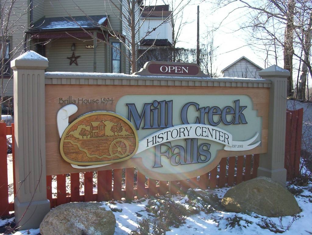
Mill Creek Falls in Newburgh Township, Ohio (see a map)
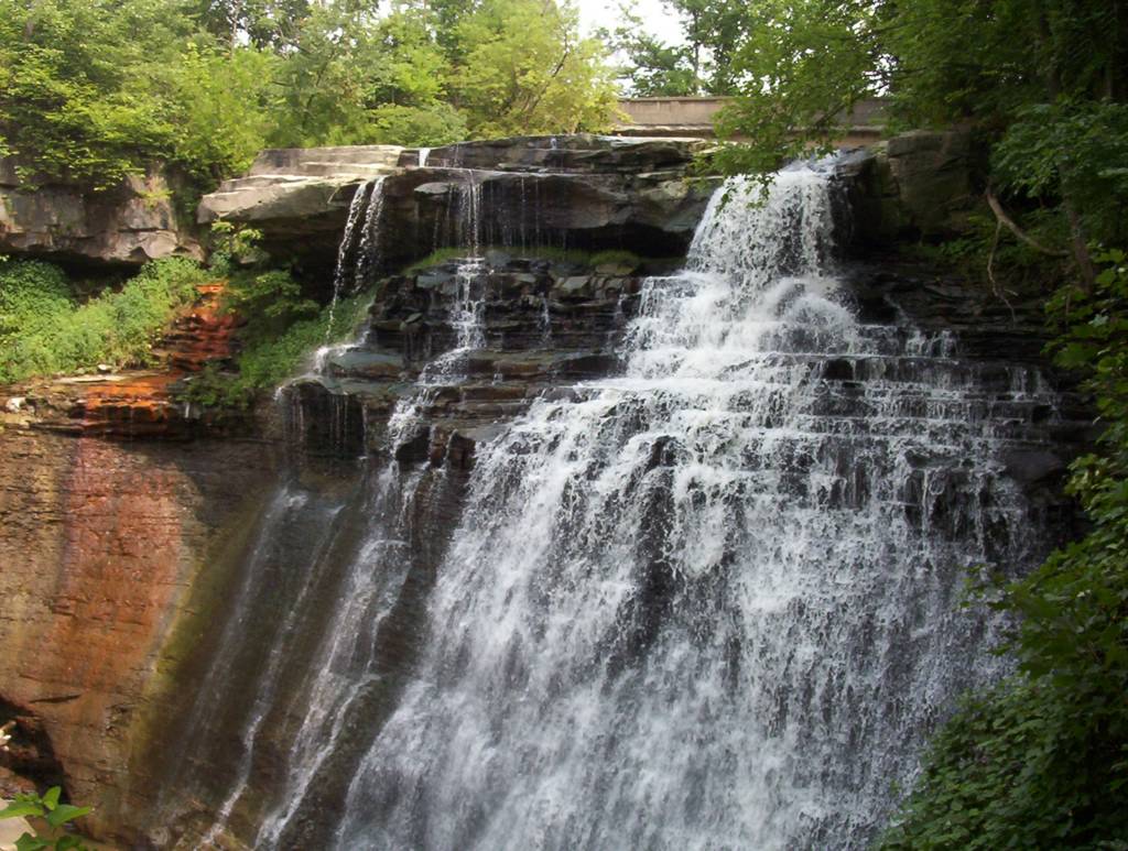
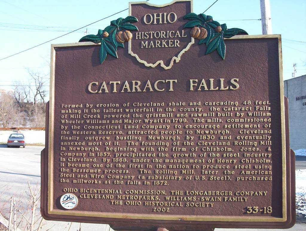
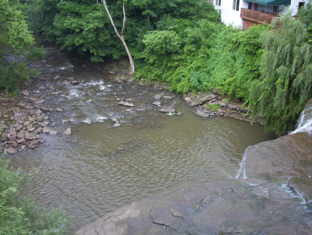
Mill Creek is the second largest tributary of the Cuyahoga River. Mill Creek Falls, which drops 48 feet, is the largest waterfall in Cuyahoga County. Settlers established Newburgh Township in 1799 on the Indian trail that later became Broadway avenue. What a difference...can you believe that the busy Broadway avenue today was once an old Indian trail?
In the 1800s, Mill Creek Falls gave power to lumber and grain mills and once Newburgh was larger than the City of Cleveland. How times change... Now Newburgh is not even a town but just a small township. The area is also known as Slavic Village.
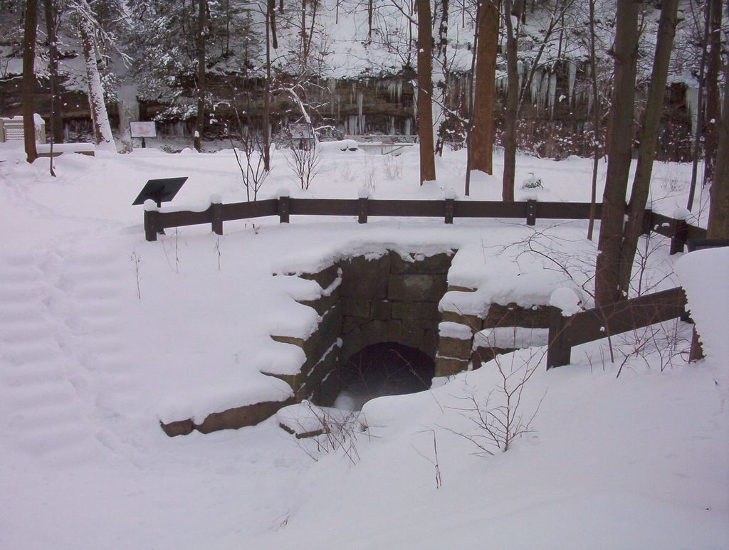
Then, in 1900s, people did not need the water power anymore. Waterfall stood in the way of early railroad and in 1905, the railroads moved the falls to accommodate train tracks. How do you move a waterfall? The engineers sent the stream into a different part of the gorge 100 years ago. While you enjoy the waterfall, you can see and hear trains passsing just above your head on the cliff above the river.
More photos: America Byways.org
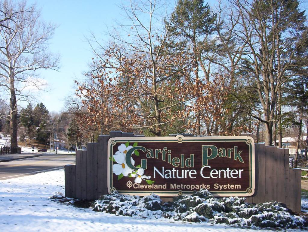
Garfield Park; Mill Creek Falls; Falls Info
Funny enough, there is no map of the falls on the web. You have to find your way to the Garfield park and then to the falls. The best thing to do, is to stop at the park office (photo 1) just off Broadview Ave. (on you left side) and to ask for directions and maps. People at the office are very helpful. Basically, you just drive up the hill from the park office (for 1-2 minutes), and then turn right on Garfield park Blvd. You will see the Peter and Paul church in front of you. Here, you turn again right on Turney road, and then drive north on Turney for about one mile. At the second traffic light, you have to veer left to enter the Mill Creek Falls parking lot (photo 2). The falls were moved 100 years ago, and the new platform allows a view from the site which does not do justice to the highest waterfall in the county. The culprits for moving the falls, the railroads, still run trains passing just above the gorge (and above your head). There is a small museum at the parking lot.
Anyhow, the other waterfall in the area is much more worth visiting.
How to get there?
Just get back to Broadway ave. (follow the same route back to the Garfield Park office) and turn right going to downtown Bedford. It is a 8-9 miles journey. Stop in downtown Bedford to see the beautiful historic buildings there (the parking lot is just off Broadway ave., on your right).
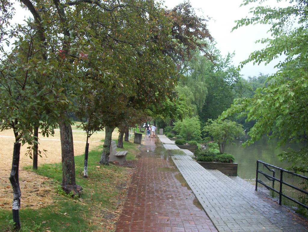
Then, drive down (south) Broadway ave. until you see a small green sign on your right for the Viaduct Park. Go right on Taylor road, and you will see the park entrance in about 1000 feet. The entrance is rather unusual because there is an one meter in diameter round metal sign for Viaduct park instead of the usual rectangular green Metro parks sign. The viaduct is just in front of you, behind the parking lot. There is a small road on the left of the viaduct which will lead you to the Tinkers Creek Falls. There you will see the remnants of an old mill and a dam. You can even crawl in the old water tunnel if you feel Indiana Jones-like. Downstream the Tinkers Creek disappears into a man-made tunnel called the Arc, made to support, you guessed it, the railroad above. And here it goes another train, racing at full speed just above you head on the viaduct. In NE Ohio, the nature and the early industry are so intertwined that is hard to think of them without the other. It seems like the industry was a part of nature since primeval times. There are remnants of ruins of industrial activity wherever you go - Brandywine falls, Elyria falls, Ashtabula, Tinkers Creek. These are old, long forgotten factories around which the whole villages used to form.
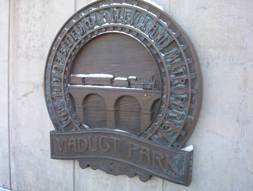

Viaduct Park; Tinkers Creek Falls
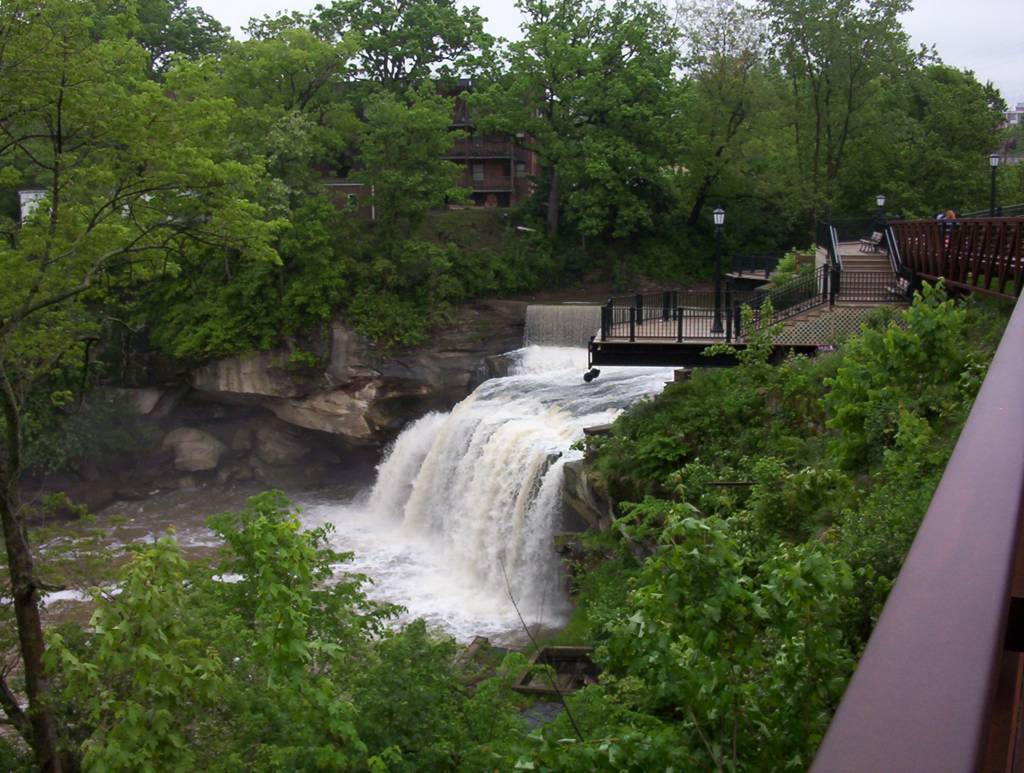
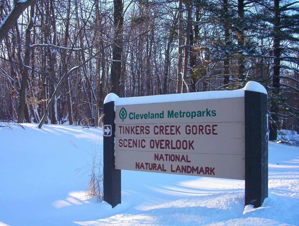
Great Falls at Tinker Creek in Bedford, Ohio
Tinkers Creek is named after Joseph Tinker who was the principal boatman for Moses Cleveland's survey crew. The city of Cleveland is named after Moses. Tinker died in a boating accident on a return trip to New England. The steepness and rockiness of the Tinkers Creek's gorge made the land along the creek inaccessible preserving it as a natural area. The Great Falls (15 feet high) is in Bedford's Viaduct Park which is just south of Cleveland.
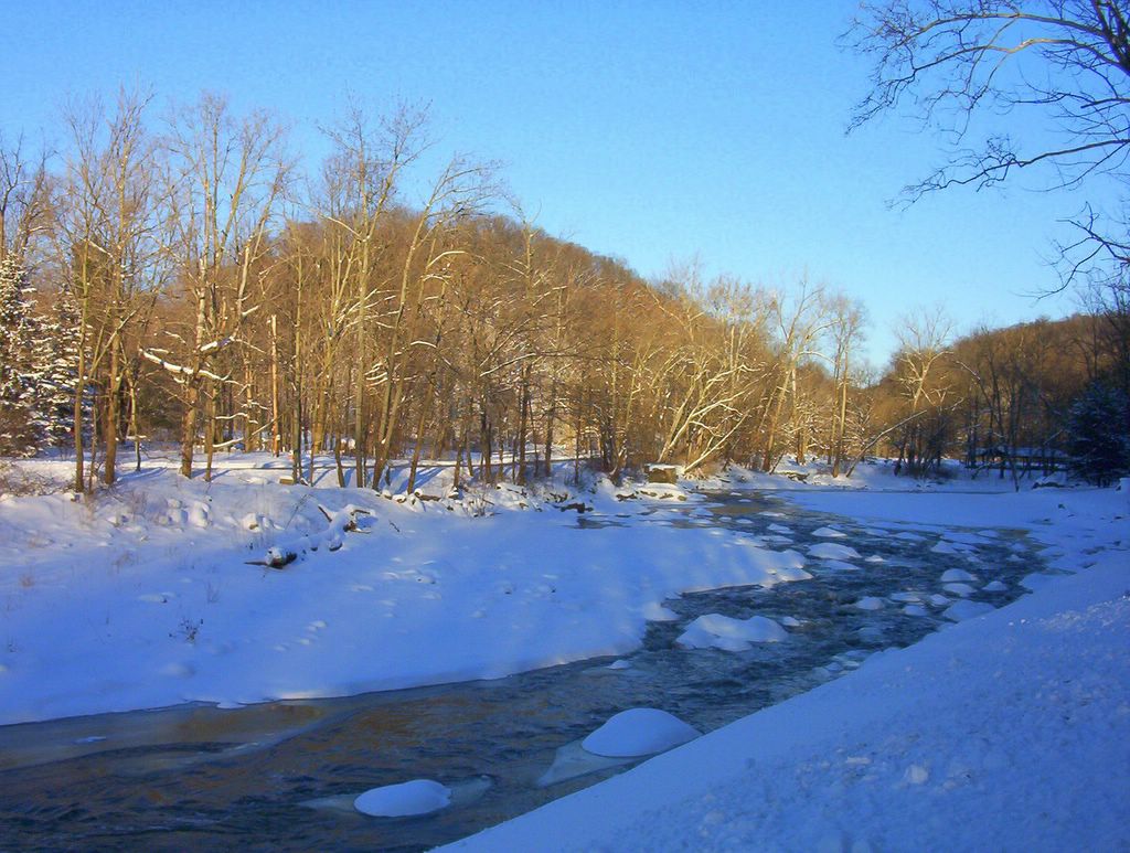
The stream drops a dramatic 220 feet over a course of two miles and has cut a steep, walled gorge. There are many cascades and small falls within the gorge. There is a viaduct built in 1865 over the Tinkers Creek gorge.
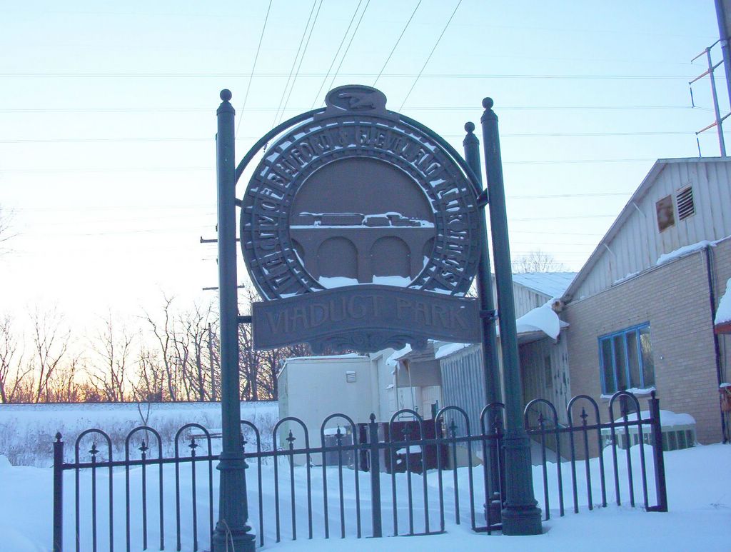

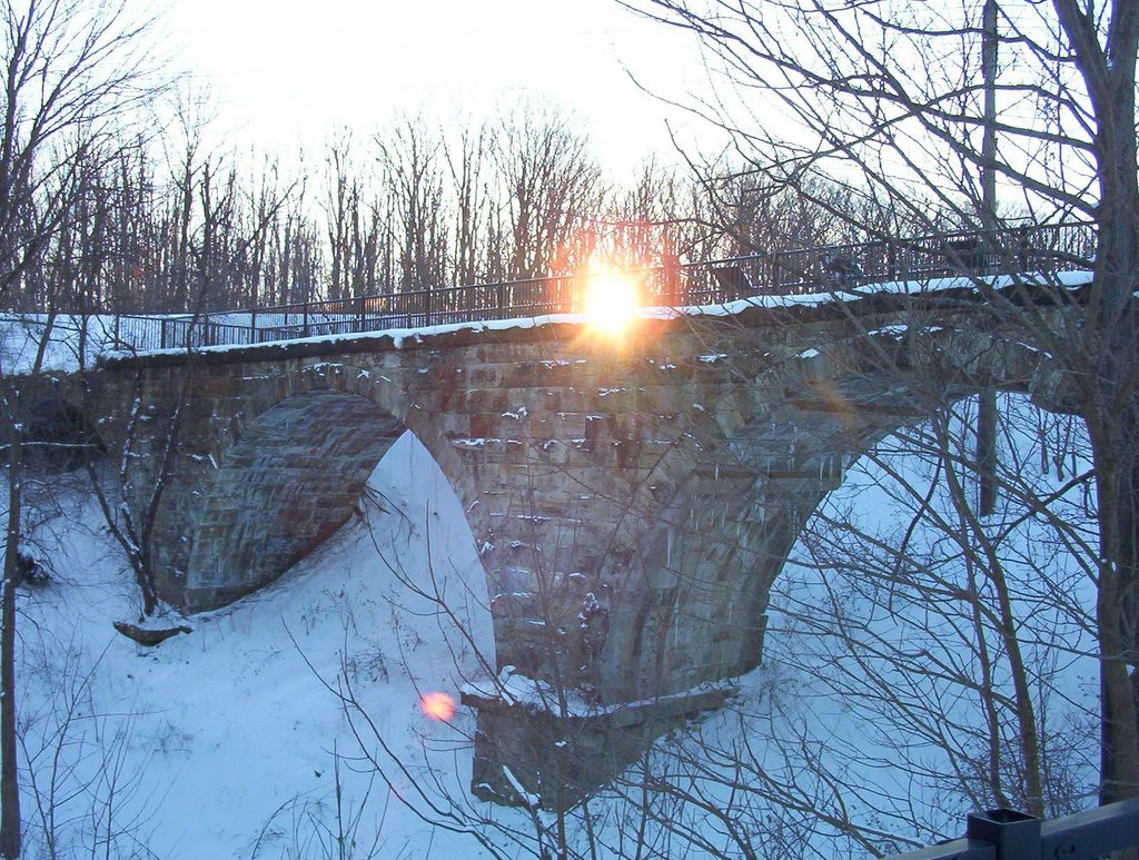
Viaduct park metal sign; Viaduct history; The Viaduct at sunset
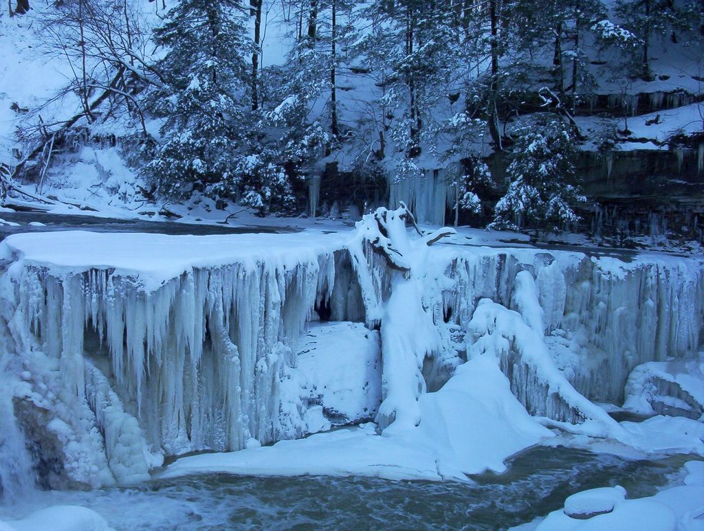
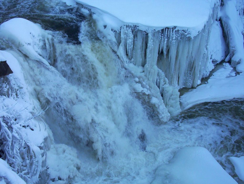
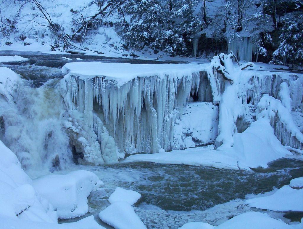
Tinkers Creek Frozen Waterfall; Close-up view
Old mill water tunnel
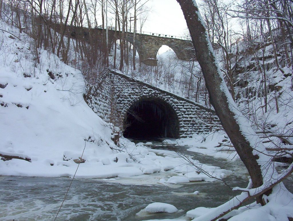


The Arch tunnel; How it was built; A train passing on the viaduct


Tinkers Creek Gorge; View at the gorge


Tinkers creek bridge; Snow covered trees; Tinkers creek and floating ice
Brandywine Falls
Brandywine Falls is very scenic and easy to visit (see the location on Google Maps). It is one of the highlights of Cuyahoga Valley National Park. There is a parking area, trail and board walk to the base and the top of the falls.

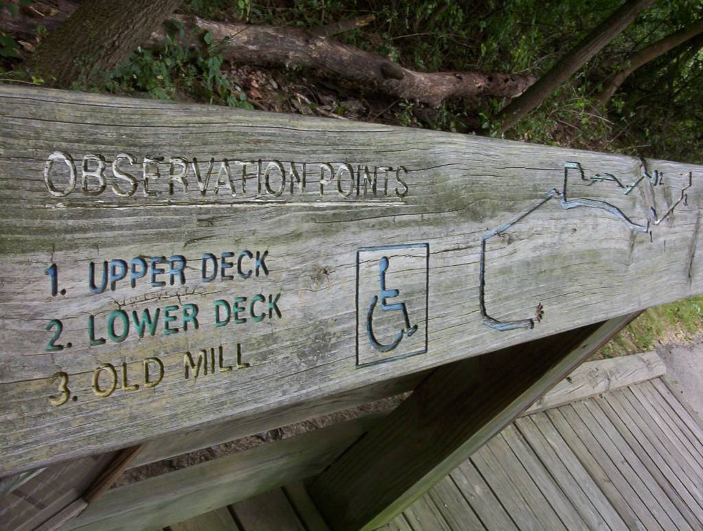

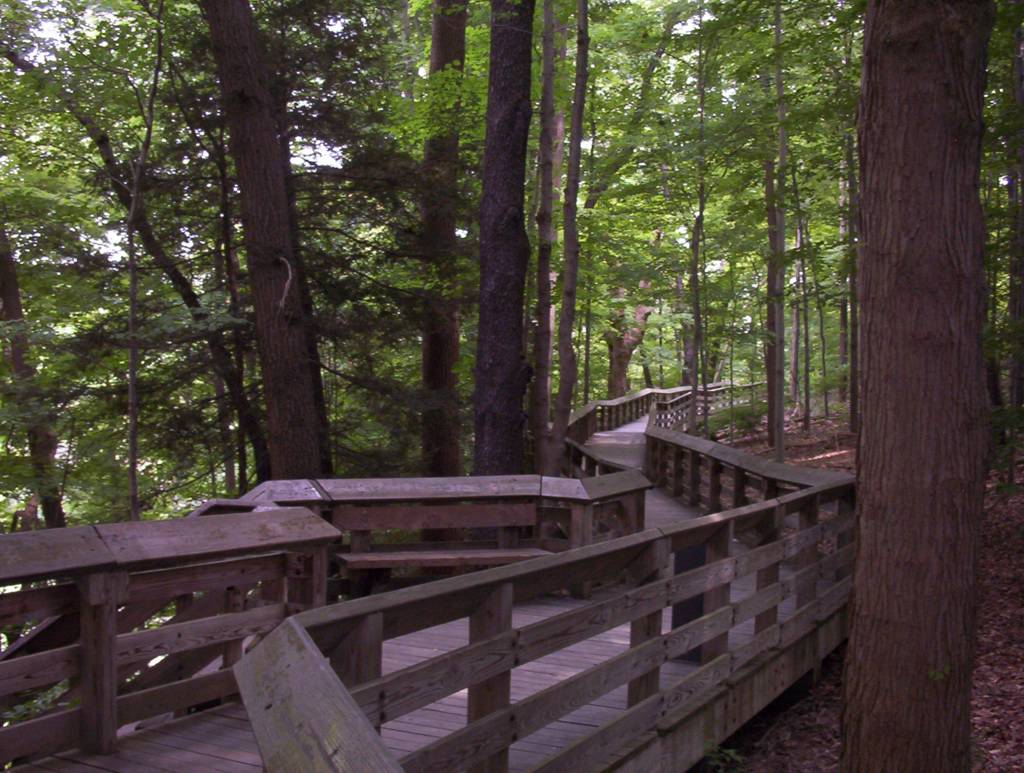
Brandywine Falls. This is the wooden deck. First, we'll try the upper level. It's a "rough road" (see the sign above) to the low deck, so be careful.


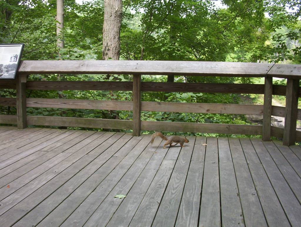
Old trees on the way to the upper deck; Even the squirrels are anxious to see the falls...
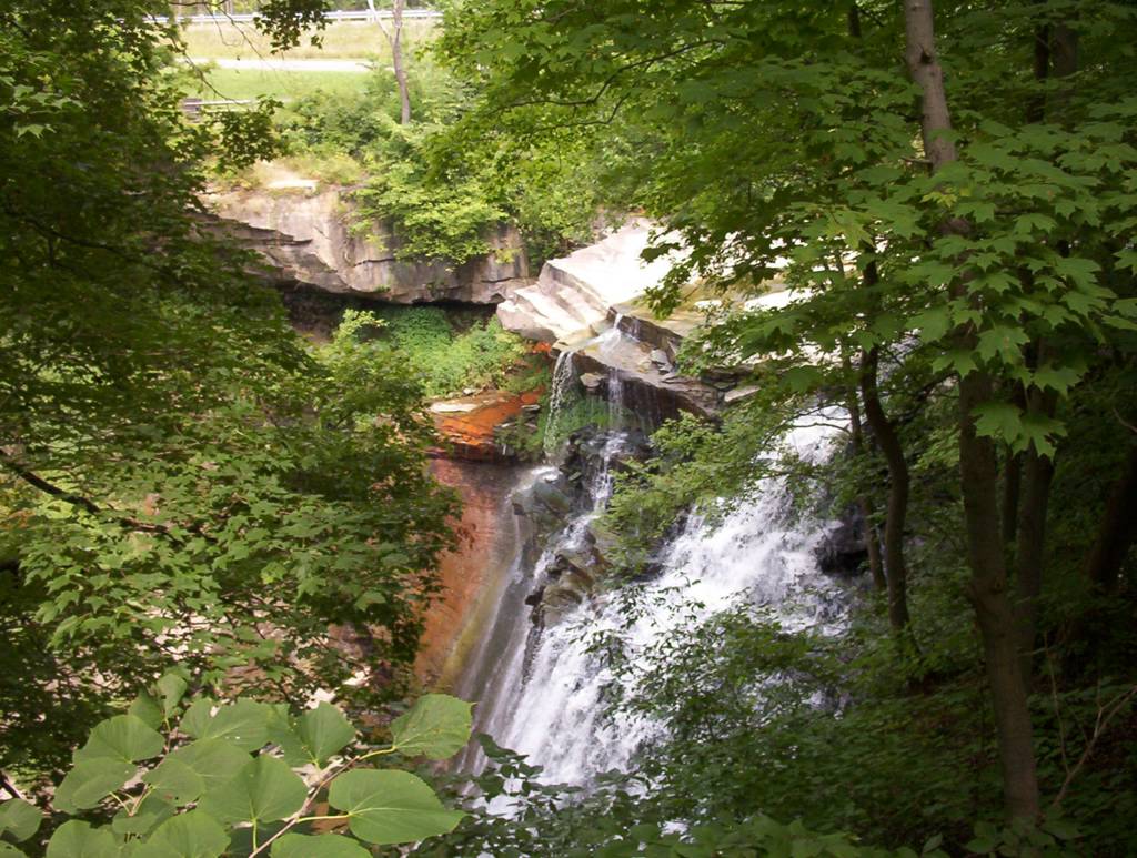
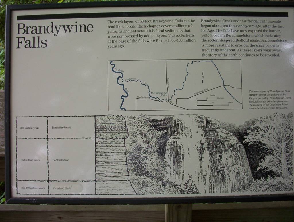
A glimpse at the multi-colored rocks at the falls; There are 3 different layers of rock at the falls in 3 different colors.


View from the top of the falls, stay back from the edge...

In 1880s, there was a whole village here which had disappeared. Not all early settlements were successful...
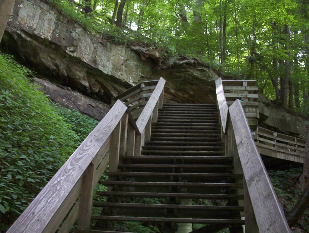


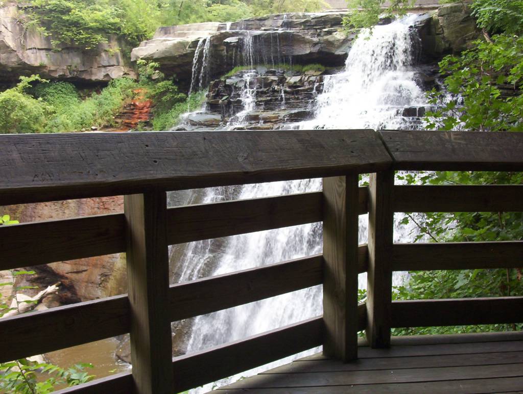
A lot of stairs to the lower deck; A view from the lower deck

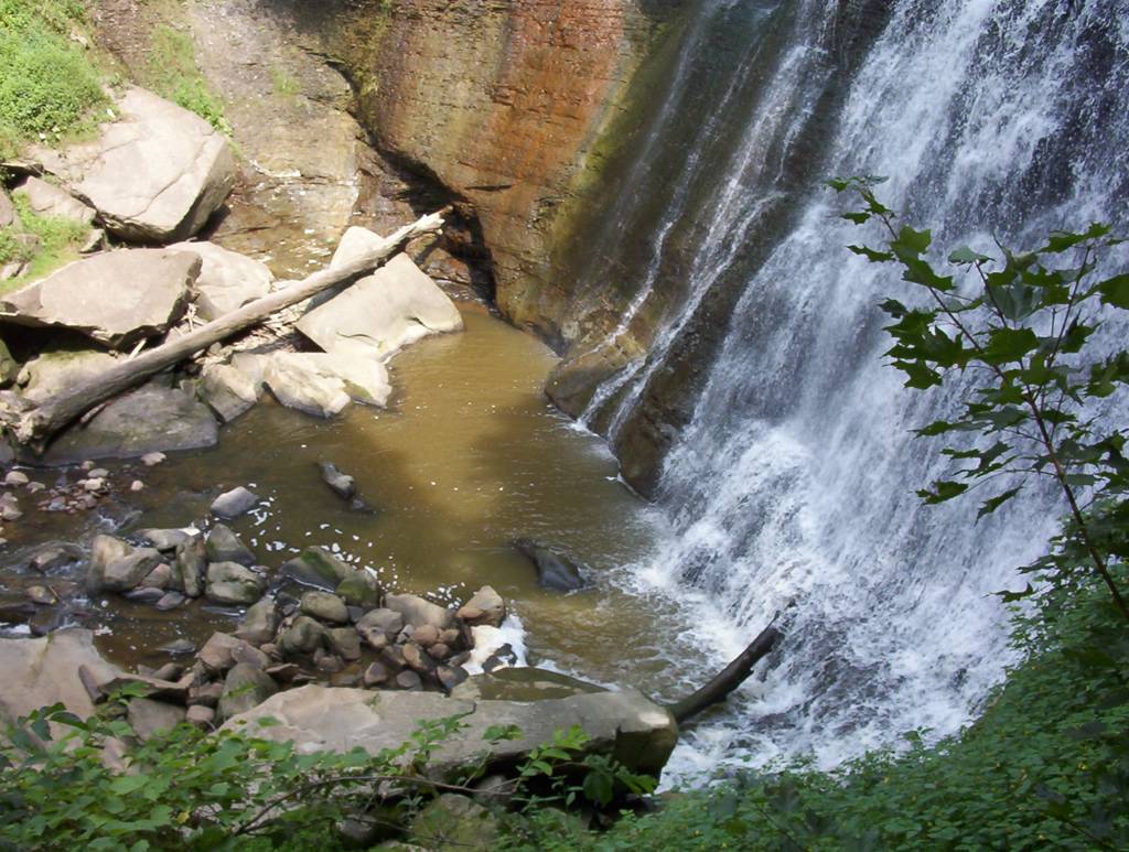

The falls
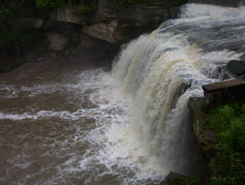
Elyria East Falls of the Black River
These are urban waterfalls in downtown Elyria which is 30 miles west of Cleveland. There is a nice observation deck just above the falls. There was an electric power station here in the 1920's. A small dam just above the falls and other ruins still remain. There are also West Falls down on the same river.

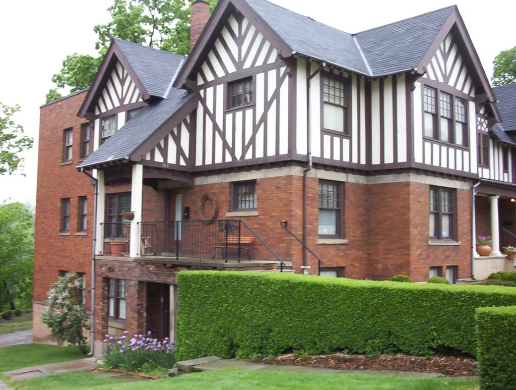
Downtown Elyria; An old style house, the falls are on the other side of the Black river


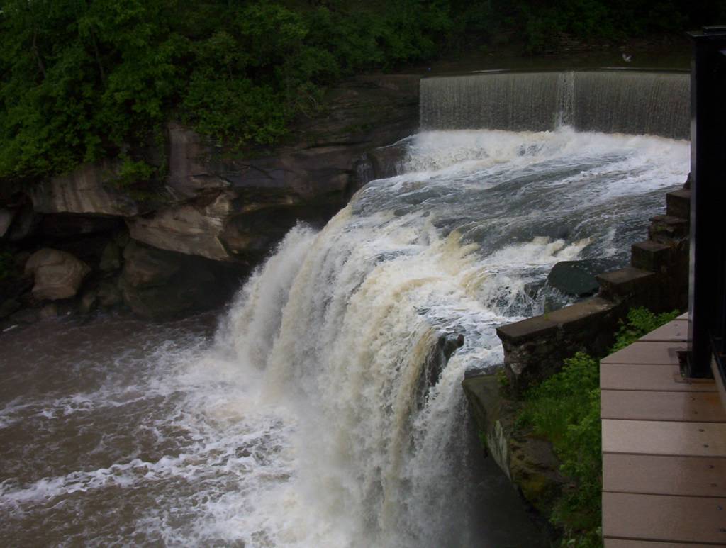

Falls

View from the new platform built in 2001. The old style house from the previous pictures is just in front of us on the other bank of the river. The parking lot and the city police station (and jail) are just behind us.
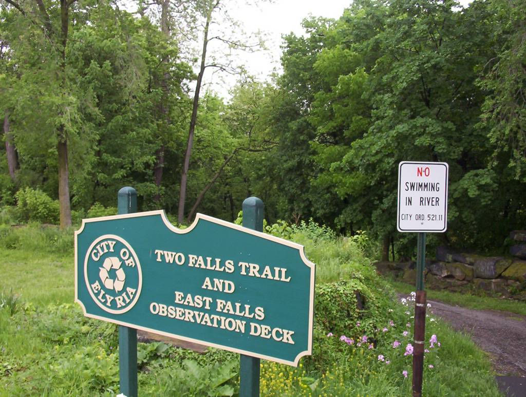

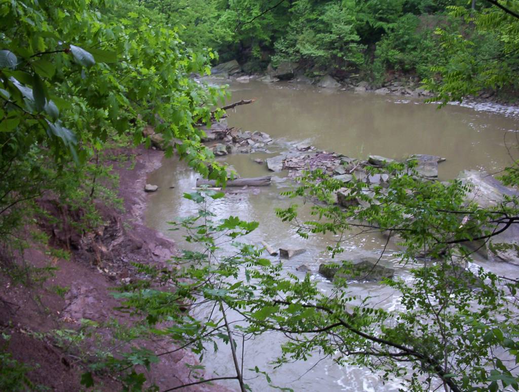
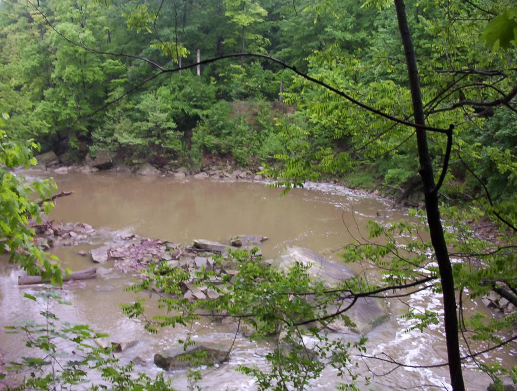
A trail connects the two Elyria falls. The East fall is the one downtown with the modern observation deck. All these pictures were taken from there. Views from the forest trail connecting the two falls


East falls; The falls are really beautiful; The observation deck

Last view at the falls from the bridge over the Black river
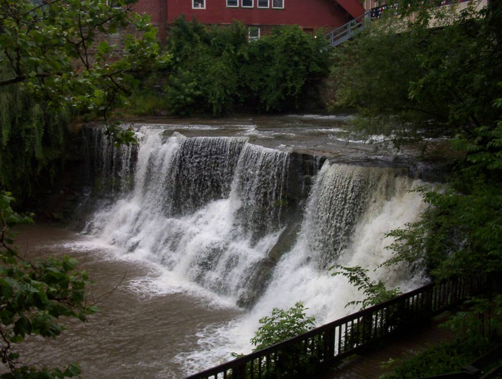
Chagrin Falls
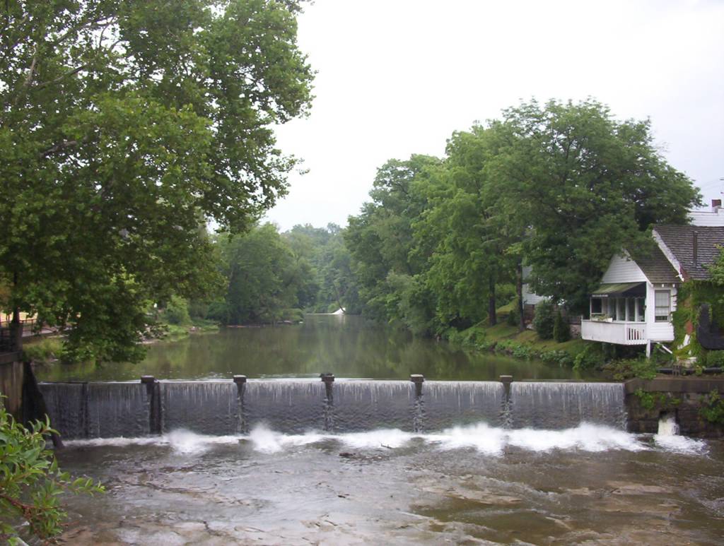
Waterfall is located right in the heart of the town of Chagrin Falls, 25 miles east of Cleveland. The Main Street bridge is just above the waterfall. A small dam is just upstream on the other side of the bridge. There is a boardwalk that takes you down to view the falls.
Chagrine Falls - a view from the Main street bridge; This is the riverwalk


There is a beautiful river walk but it turned out to be a very rainy day, as you can see; Tulips in the summer rain
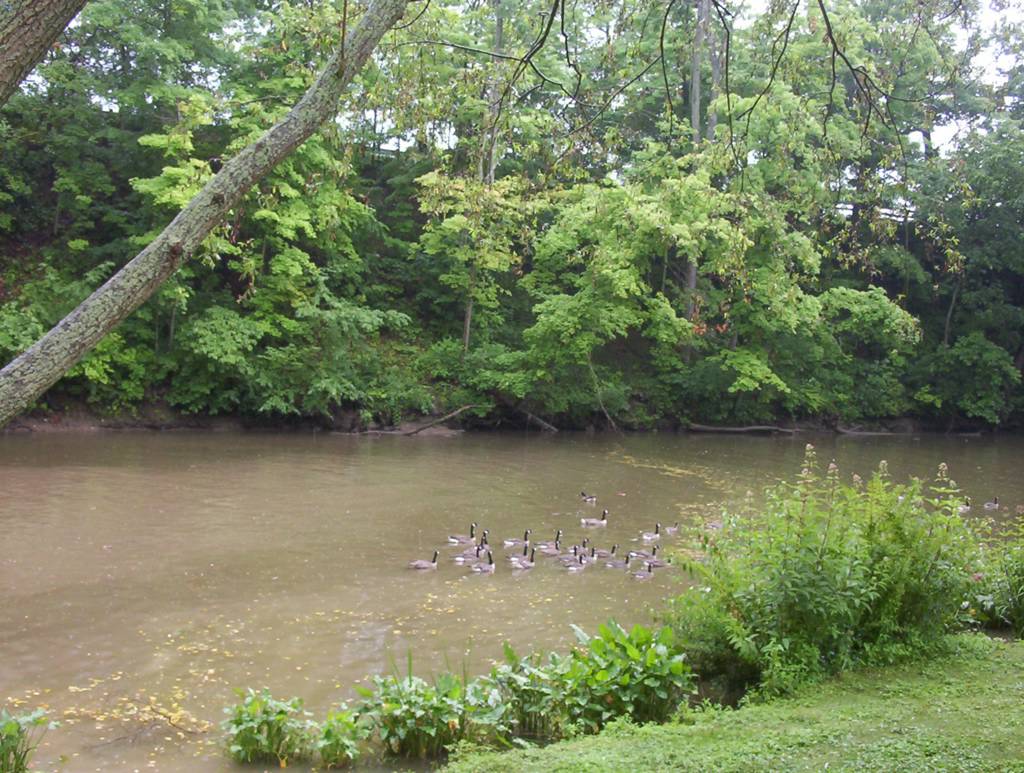
Every summer, there is a Rubber ducky fest in Chagrin Falls but these are real ducks.
This is the place where they let thousands of rubber duckies to swim downstream. And no, this is not the true Chagrine Falls
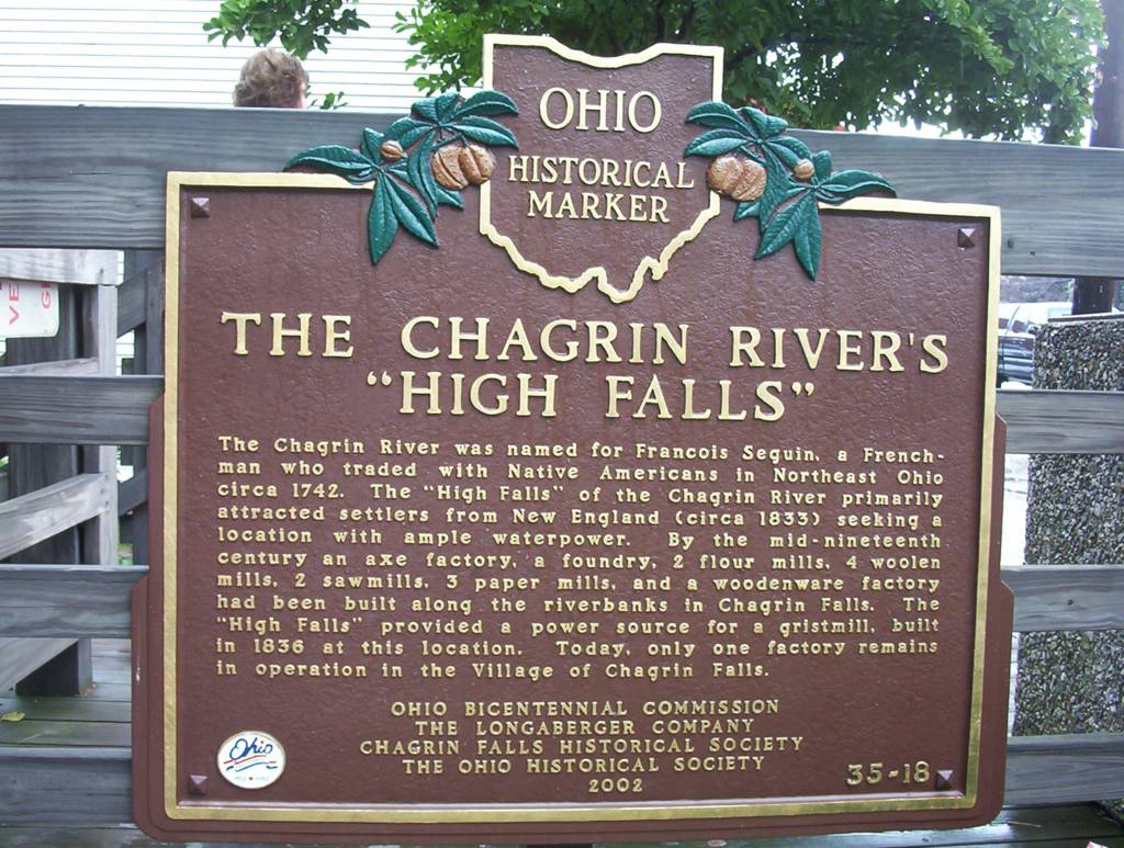
The "High falls"


The Falls
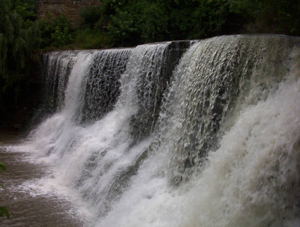

Close-up view
References:
Go Waterfalling.com (source of the falls links above)
Mill Creek Falls - Cleveland Metroparks
Cleveland Metroparks - Plain Dealer
American White Water.org
Tinkerscreek.org
Cuyahogavalley.net
Brandywine Falls - RodWatson.com
Video: A Day In Cuyahoga Valley National Park. YouTube.
Published: 2004
Last updated: 04/14/2007
Nice work done by the author. Lovely & amazing pictures which have attraction. I am making my mind to visit their in coming next holidays
ReplyDelete